
A truck cab in the 1980s could contain nearly everything needed to cover thousands of miles, but very little of it was connected. The road atlas handled route planning, the CB carried information from nearby trucks, handwritten directions helped with the last few miles, and contact with the terminal often waited until there was access to a telephone.
Much of that routine will be familiar to people who were driving at the time. What followed was a decades-long transition that brought satellite messaging, electronic navigation, vehicle location, mobile internet and electronic records into the cab, changing how information moved throughout a trip.
When the Truck Was Between Check Calls
Before in-cab messaging became widespread, load updates depended heavily on telephone calls. Scheduled check calls from truck stops, terminals, and other locations with phone access gave drivers a chance to report their location, update an arrival estimate, and find out what was coming next.
Truck-stop pay phones became closely associated with that routine. Accounts from people who drove before widespread cellular service describe carrying change or prepaid calling cards, calling in after deliveries and checking back when another load was not immediately available. Some truck stops went well beyond a few phones near the entrance, installing them at restaurant tables or in booths so calls could be made during a stop.
CB radio filled another communication gap. Its role in trucking grew sharply during the 1970s, when fuel shortages and the nationwide 55 mph speed limit helped push the radio into wider use. The Smithsonian’s National Museum of American History has documented CB’s rise as a major cultural phenomenon during that decade, while contemporary accounts describe truckers using it to exchange information about fuel availability, traffic, crashes, and enforcement activity.
Unlike a telephone call back to the terminal, the CB offered information from people nearby. Conditions a few miles ahead could be passed from truck to truck before they reached the next exit or appeared in an official report.
Route Planning Required More Than an Address
Highway maps could establish the general direction of travel, but commercial trucking needed information that ordinary road maps were not designed to provide. Rand McNally introduced the Motor Carriers’ Road Atlas in 1982, and the commercial atlas developed around information such as designated truck routes, restricted roads, low clearances, and weigh station locations.
The highway portion was only part of reaching an unfamiliar customer. A mailing address did not necessarily identify the truck entrance, and written directions from a customer, terminal, or another trucker could include the landmarks, gates, and turns that mattered once the interstate portion of the trip was finished.
Useful directions were often worth keeping, particularly for facilities that were difficult to enter or likely to appear on another trip. The notes collected over time became another reference alongside the atlas and knowledge gained from repeatedly traveling the same corridors.
Commercial mapping was also moving toward computers. Rand McNally acquired Transportation Data Management in 1980, combining its mapping database with an electronic routing and mileage system used by the transportation industry. TripMaker software followed in 1994, with StreetFinder street-navigation software arriving in 1996.
Satellite Messaging Changed the Check-Call Routine
One of the biggest changes in communication arrived before smartphones or widespread in-cab GPS. Qualcomm introduced its OmniTRACS system using a two-way satellite data link to connect trucks with operations centers, allowing messages and vehicle-position information to travel without relying on a telephone stop.
Research from the Federal Highway Administration documented an early installation in a 5,000-vehicle commercial trucking fleet in 1988. By the time FHWA published its findings in 1996, OmniTRACS was operating in more than 50,000 trucks.
Load information could now be sent directly to the truck, while location updates no longer depended entirely on someone calling in and reporting where the equipment was. Adoption continued during the following decade, with Qualcomm reporting more than 250,000 OmniTRACS terminals sold worldwide by 1998 and more than 800 trucking companies and other mobile customers using the system.
The change did not reach every operation at the same pace, particularly in an industry made up of fleets of vastly different sizes. Telephone check calls remained part of trucking while satellite systems established a new way to exchange information with equipment already on the road.
Electronic Navigation Moved Into the Cab
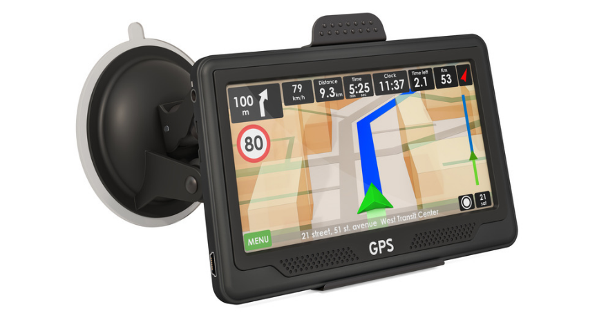
As digital maps and GPS hardware improved, truck-specific navigation began combining a vehicle’s location with route calculations designed around commercial travel. Vehicle dimensions and roadway restrictions could be incorporated into the route, while missed turns or changes in plans could be recalculated without rebuilding the trip manually.
Commercial routing still depended on accurate underlying information. An incorrect clearance, outdated restriction or misplaced customer entrance could create problems when the route on the screen did not match conditions on the ground.
Printed commercial maps consequently remained available as electronic navigation became commonplace. Rand McNally released its 2027 Motor Carriers’ Road Atlas in June 2026 with updated truck routes, restrictions, low-clearance information and weigh station locations, positioning it as a planning resource and backup to electronic navigation.
The Cab Began Creating Its Own Records
Connectivity eventually expanded beyond messages, routing, and vehicle location. Electronic systems could collect information directly from the truck, reducing the amount that had to be manually reported or recorded later.
Electronic logging became one of the most visible examples. A compliant ELD synchronizes with the commercial vehicle’s engine and automatically captures information including engine power status, vehicle motion, miles driven, and engine hours. That information contributes to the electronic record of duty status, which must be reviewed and certified for accuracy.
An ELD should not be confused with a federal requirement for continuous real-time tracking. The Federal Motor Carrier Safety Administration does not require ELDs to provide real-time vehicle tracking, although carriers can use separate or connected technology with that capability.
Federal rules also address how information generated through those systems can be used. FMCSA prohibits harassment involving ELD information or technology used with an ELD when the conduct meets the agency’s regulatory definition.
Smartphones Brought Separate Resources Onto One Device
Cell phones initially removed the need to find a stationary telephone. Smartphones later brought communication, mapping, traffic information, weather, internet searches, photographs, and other resources onto one portable device.
That combination became particularly useful around unfamiliar facilities. An address could be compared with satellite imagery, the receiver could be called directly, and an alternate approach could be checked before reaching a questionable turn.
Road information expanded beyond what could be heard over the CB or gathered before departure. Connected mapping could show congestion across a wider area, while mobile access made it possible to check changing conditions farther along the route.
Carrier communication developed alongside those consumer technologies. Mobile apps and connected fleet platforms created additional ways to exchange trip information, documents, and updates without waiting until the truck reached another stop.
One Career Could Span the Entire Shift
Someone who entered trucking before widespread cellular service could have started with check calls, a road atlas and handwritten directions, then watched satellite terminals, GPS navigation, electronic logs, smartphones and connected fleet platforms arrive during the same career.
Those developments changed more than the equipment mounted inside a truck. Information that once had to be collected before departure, passed along by another trucker or picked up at the next stop increasingly became available while the trip was underway.
They also changed how much information could travel in the opposite direction. Vehicle location, duty-status data, and other operational details could increasingly be captured or transmitted electronically instead of depending on a later phone call or handwritten record.
The transformation took place over decades, which is why the experience of trucking before widespread connectivity remains within living memory across the industry. Many of the people who watched that change happen are still behind the wheel today, carrying firsthand knowledge of both sides of one of the largest technological shifts in modern trucking.
FAQ
Why did trucking adopt satellite communication before widespread cellular data?
Long-haul trucks routinely traveled across large geographic areas where reliable mobile data networks did not yet exist. Satellite systems could provide communication and vehicle-position capabilities across a broad operating area without depending on terrestrial cellular coverage.
How did electronic routing develop before dashboard GPS became common?
Commercial routing software was already being developed for computers before turn-by-turn GPS units became widespread in trucks. These systems helped transportation companies calculate routes and mileage electronically, while later in-cab navigation combined digital maps with the vehicle’s current location.
Is truck-specific GPS different from navigation designed for passenger cars?
Yes. Commercial navigation can incorporate information relevant to larger vehicles, including dimensions and certain roadway restrictions. Those features are important because a route suitable for a passenger vehicle may not be appropriate for a tractor-trailer.
Does federal law require trucking companies to track trucks in real time?
No. FMCSA’s ELD requirements do not mandate continuous real-time vehicle tracking. A company may separately use fleet-management, telematics, or other connected systems that provide location information.
Why are ELDs included in the history of trucking communication and navigation?
ELDs represent a later stage of the connected cab because information began moving electronically from the vehicle as well as into it. Engine-synchronized data used in electronic records of duty status became another part of the information generated during a trip rather than recorded entirely by hand afterward.
The TDUSA editorial team creates practical, driver-focused content covering trucking news, industry updates, safety, regulations, and career information for professional truck drivers across the United States. Each article is built to reflect real-world experience, industry developments, and information drivers can use on and off the road.
Last Updated: September 29, 2026