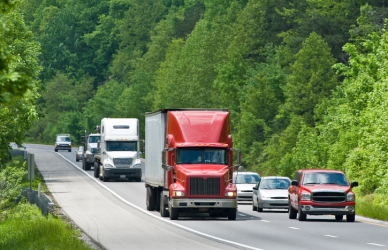


The United States’ interstate highway system is the backbone of the nation’s freight transportation, carrying over 70% of all freight tonnage annually. Among these, six key routes stand out for their vital roles in moving goods across the country. Each serves different industries and cargo types shaped by regional economies and geography.
Interstate 95 — The East Coast Consumer Goods Highway
- Runs about 1,900 miles from Miami, Florida, to Houlton, Maine.
- Transports consumer goods such as electronics, pharmaceuticals, apparel, and packaged retail products.
- Connects to major ports like Newark, Norfolk, and Baltimore, supporting containerized freight.
- In 2023, handled approximately 21 million tons of freight valued at over $104 billion.
- Faces heavy congestion, with the New York–Newark area reporting over 234,000 truck-hours of delay per mile in 2020.
Interstate 80 — The Transcontinental Bulk Freight Corridor
- Stretches nearly 2,900 miles from San Francisco, California, to Teaneck, New Jersey.
- Carries bulk commodities including grains, construction materials, and heavy equipment.
- Wyoming trucks haul more than 32 million tons of freight annually, with significant agricultural products.
- Truck volumes in eastern Ohio and western Pennsylvania range between 11,000 and 15,000 trucks daily.
Interstate 90 — The Northern Cross-Country Freight Route
- The longest interstate, at about 3,020 miles, connecting Seattle, Washington, to Boston, Massachusetts.
- Transports heavy machinery, agricultural goods, and container freight important to northern states.
- Daily truck traffic ranges from 7,000 to 14,000 vehicles along various segments.
Interstate 10 — The Southern Fuel and Produce Corridor
- Extends roughly 2,460 miles from Santa Monica, California, to Jacksonville, Florida.
- Critical for transporting energy products such as gasoline and chemicals, along with agricultural produce.
- Recognized as a primary freight corridor linking refineries and ports to inland markets.
Interstate 75 — Automotive and Agricultural Freight
- Runs from the Canadian border in Michigan to Miami, Florida.
- Supports automotive manufacturing shipments and fresh produce transport.
- Notably congested near Chattanooga’s I-24/I-75 interchange, impacting freight efficiency.
Interstate 40 — Intermodal and Consumer Goods Freight
- Covers about 2,500 miles from Barstow, California, to Wilmington, North Carolina.
- Connects urban centers and intermodal freight terminals.
- Frequently carries containerized freight and consumer goods.
- Experiences congestion near Memphis and Oklahoma City.
Factors Influencing Freight Cargo on Major Routes
- Port and rail access: Supports containerized freight on corridors like I-95, I-10, and I-40.
- Regional industries: Auto manufacturing along I-75, agriculture near I-80 and I-90, energy transport on I-10.
- Population density: Denser urban markets increase the volume of high-value, time-sensitive goods.
- Traffic congestion: Bottlenecks add delay and cost, highlighting infrastructure improvement needs.
Why Understanding These Routes Matters
Knowing the cargo types and freight volumes on these highways helps logistics planners optimize routing and scheduling. Policymakers can prioritize infrastructure investments to reduce bottlenecks. Businesses relying on freight transport gain insights for supply chain and site selection decisions.